El Qlai’at village houses a forgotten and neglected fortress. It sits on a low hill which commands the maritime plain of Akkar district.
Toponym
The fortress was known during the crusader era as “Coliath”or “La Colée” – a French translation of El Qulai’a, meaning the small fortress. El Qulai’at, plural of El Qulai’a, is the current appellation of the fortress and the village surrounding it.
Construction
Many scholars attribute the construction of the fortress to the Crusaders during their early years of invasion.
In the absence of any epigraphic document or site inscription, nothing can be said for sure.
History
The fortress was part of the County of Tripoli during the crusader era, and was barely mentioned in historical resources, maybe due to its mediocre military role at the time.
Pre-11th century – No mention of the fortress
1128 – The fortress was given by Count Pons of Tripoli (1112 to 1137) to the The Order of Knights of the Hospital of Saint John of Jerusalem.
1153 – The possession of the fortress is still confirmed to the Order of Knights by Pope Eugene III.
1208 – Mamluk Sultan Malik El-Adil Abu Baker seized the fortress by treaty and destroyed it before his march on Tripoli.
1212 – German traveler Wilbrand d’Oldenbourg recalls that “Culicath, a castle destroyed by the Saracens (Arabs)”. This confirms that the fortress was still in ruins since its destructions 4 years earlier.
1266 – Mamluk Sultan Baibars, during his campaign in Syria, seized again the fortress. This theorizes that the fortress was restored by the Crusaders between 1212 and 1266 and played again a military role within the County of Tripoli.
1282 – The fortress is mentioned as a possession to Mamluk Sultan Qalawoun following the treaties concluded with the Templers in 1282 and with the Franks in 1283.
From then on, the fortress seems to disappear from history, like other small fortresses that lost its military significance in the new kingdom and states under Mamluk rule.
Structure
Exterior
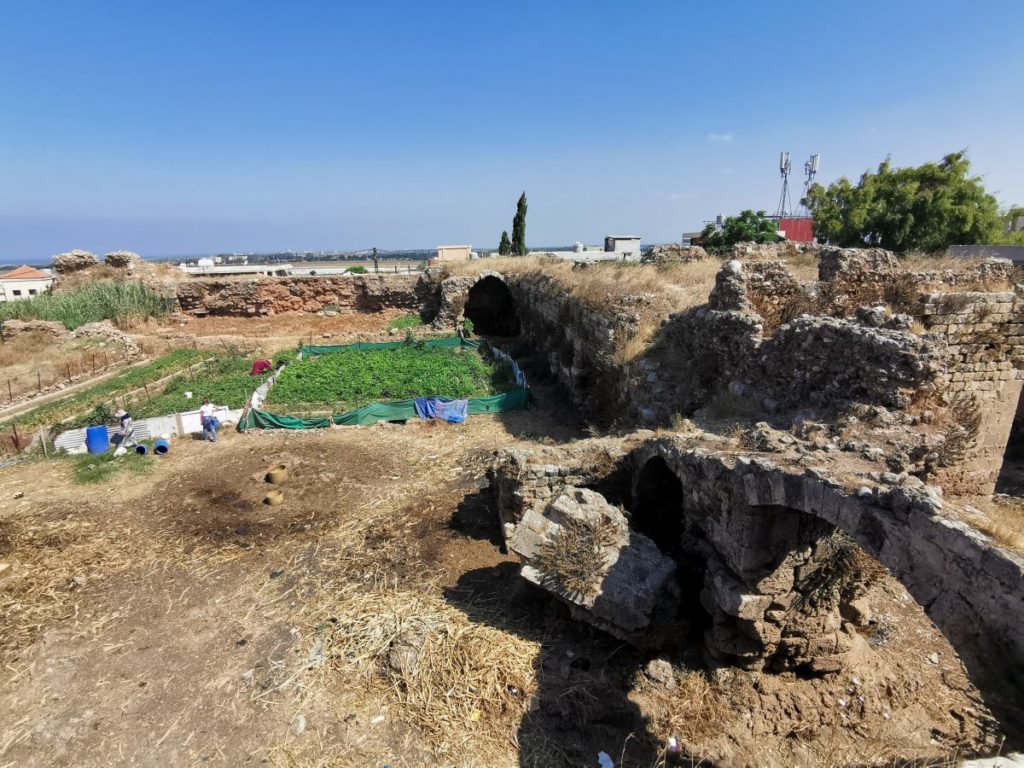
The fortress forms a square shaped plan and covers an area of approx 4,250 square meters.
The four fronts of the structure are protected by a ditch that was filled with either water or traps, partly cut into the rock, 8 to 10m wide, 1.50m deep. The middle of each front is defended by a low barlong (a rectangular-shaped element coming out of the defensive walls).
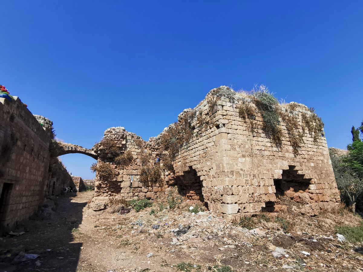
The fronts’ corners are flanked by approx 6m square towers, which all four collapsed.
The main well-defended entrance is located to the north-east of the structure, and a second smaller one is located to the south-west front.
Interior
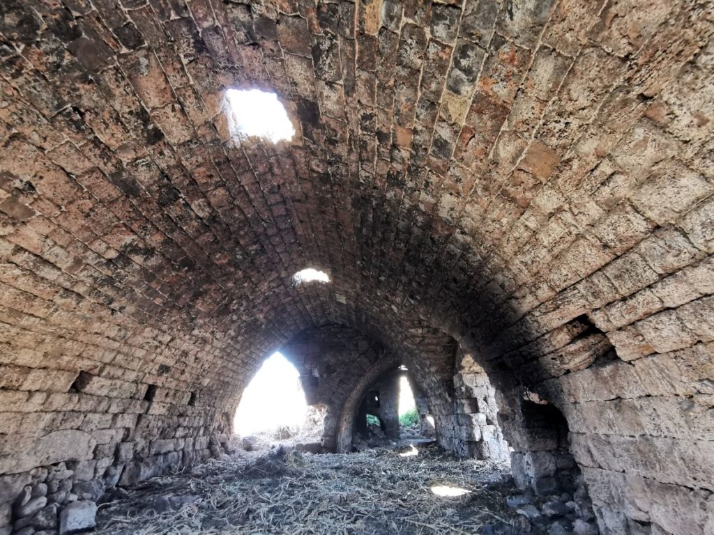
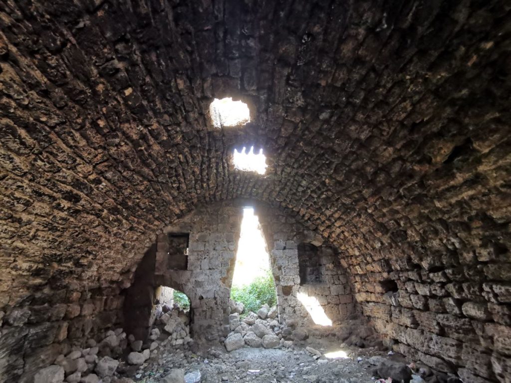
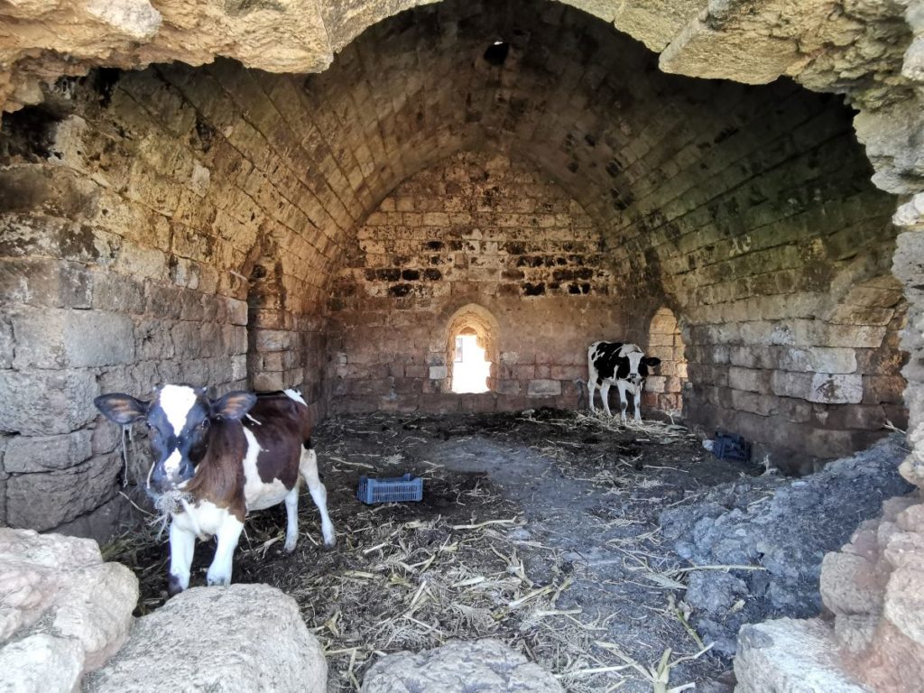
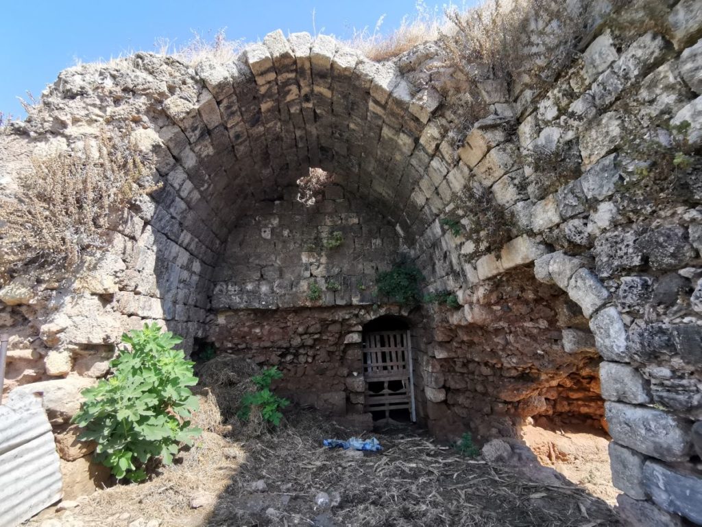
The structure is characterized by a spacious courtyard, which houses on its southern and eastern sides an arched section with roof-light openings that likely contained the rooms of soldiers, stables, a prison, a kitchen, storage spaces and underground water cisterns.
Stairs leading to the defensive walls and towers can still be seen, though it is not recommended to use it due to its degraded state, which might pose a risk on climbers.
The “gold room”, as the locals name it, is a dark room on the north-east side of the structure – locals believe that it houses a treasure protected by a jinn. It is important to note that around the courtyard one can see big holes into the ground, caused by treasure hunters.
Unfortunately, the courtyard and the rooms have been converted into a farmland and a barn. The overall state of the structure is desperate, and needs an urgent rescue mission.
Karim Sokhn
Tour Operator & Tour Guide
References:
Voyage en Syrie, Max Van Berchem et Edmond Fatio